22 LANTERN LANE
Owner Information
HANSON NANCY A TT
22 LANTERN LANE
HINGHAM, MA 02043


Property Details
22 LANTERN LANE is classified as a Single Family Residential (Cape cod).
The primary structure on this property was built in 1945. There are 3,623ft2 of built area within this property. There is 1,959ft2 of residential/living space within this property. This property is listed as having 8 rooms.
22 LANTERN LANE is valued at $715,300. The land is valued at $441,300 and the structures are valued at $274,000.
This property is in Zone XX. Confirm with local Zoning Board authorities to ensure there are no overlays or other easements on this property.
The most recent deed for 22 LANTERN LANE is recorded at the local registrar in Book 50517, Page 344. 22 LANTERN LANE was last sold on Wednesday, November 14, 2018 for $1.
Assessment data from fiscal year 2022.
Flood Data
According to the FEMA National Flood Hazard Layer, this property does not appear to be in a flood zone. It may also be in an area not yet reviewed. Nonetheless, confirm this information prior to taking any action.
To view the flood hazards around this property, create a FEMA "Firmette" Map of the area around 22 LANTERN LANE.
Broadband Internet Providers
| Provider | Type | Bandwidth (mbps) | |
|---|---|---|---|
| Viasat Inc | Satellite | 100 | 3 |
| Verizon New England Inc. | DSL | 7 | 0 |
| Verizon New England Inc. | Fiber | 940 | 880 |
| Comcast | Cable | 1000 | 35 |
| GCI Communication Corp. | Satellite | 0 | 0 |
| HughesNet | Satellite | 25 | 3 |
| VSAT Systems, LLC. | Satellite | 2 | 1 |
Broadband service provider data from December 2020.
Adjacent Properties
- 21 LANTERN LANE
Single Family Residential owned by BELL CARL D & BELL KATHERINE S - 9 MAPLE STREET
Single Family Residential owned by KENNEY MARCI L & ADAM - 7 MAPLE STREET
Single Family Residential owned by ILACQUA JOANNE - 16 LANTERN LANE
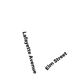
Single Family Residential owned by EBERLE ARTHUR J JR & MARGARET - 39 LAFAYETTE AVENUE
Single Family Residential owned by MCGRAIL DAVID W & KATHRYN - 47 LAFAYETTE AVENUE
Single Family Residential owned by GOLDMAN CHARLES & MELISSA